Expert Utility Surveys & Utility Mapping Services
for Safe, Efficient Construction Projects
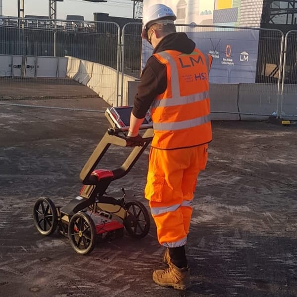
Are you planning a construction project but don't know where the utility lines are buried? One wrong move could lead to costly and dangerous consequences. You need to know where the utility lines are so you can safely and efficiently complete your project without any issues. That's where Amethyst Surveys come in. Our Utility Surveys & Utility Mapping Service is designed to help you identify the location of underground utilities before you start digging.Our team uses the latest technology and techniques to create detailed maps of utility lines. Using Electromagnetic and Ground Penetrating Radar equipment with record information, direct visual inspection and data collection via GPS or Total Station, means we can undertake utility surveys and utility mapping to any level of PAS 128 requested. We'll help you identify potential hazards so that you can avoid them, saving you time and money. With our utility mapping service, you'll have peace of mind knowing that you can proceed with your project safely and efficiently, without the risk of damaging any utility lines. Don't risk damaging utility lines and causing costly delays in your project. Contact Amethyst Surveys today to schedule your utility mapping service.
OUR UTILITY MAPPING SERVICES – PAS 128
We undertake projects ranging from locating single utilities for connection or maintenance purposes, borehole clearance surveys, production of virtual trial holes through to network and utility asset mapping for industry and construction schemes.
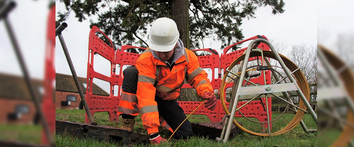
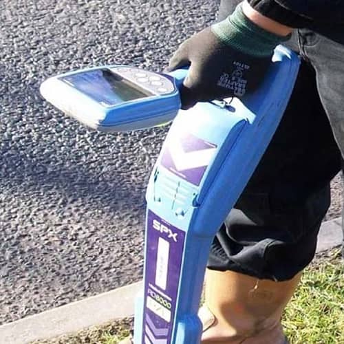
Using Electromagnetic and Ground Penetrating Radar equipment with record information, direct visual inspection and data collection via GPS or Total Station, we can undertake utility mapping surveys to any level of PAS 128 requested.
Identification of routes, types and depths of underground utility services
Allows for the identification of potential conflicts enabling effective planning
Allows for more competitive tenders and reduces the potential for contract delays
Reduces the costs associated with the digging of speculative trial holes
Mitigates the potential for cable strikes and damage to third-party services
Complies with HSE (HSG47) requirements and CDM guidelines
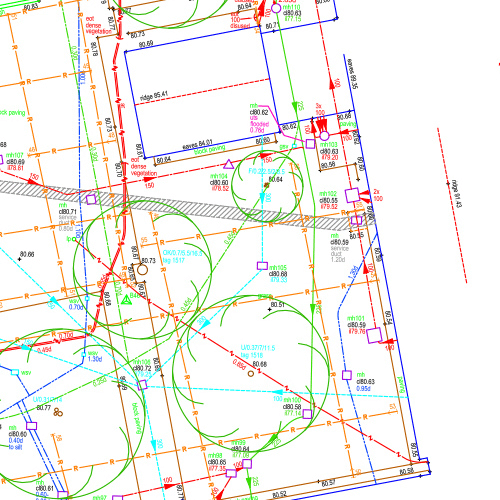
Our underground survey presentation includes subsurface utility mark out and digital AutoCAD files in 2D & 3D
Undertaken to TSA guidelines and PAS 128
Who We Have Worked With
How It Works

1. Contact Us For Utility Mapping Survey
Speak to one of our Utility Survey experts about your project.

2. We Carry Out Utility Mapping Survey
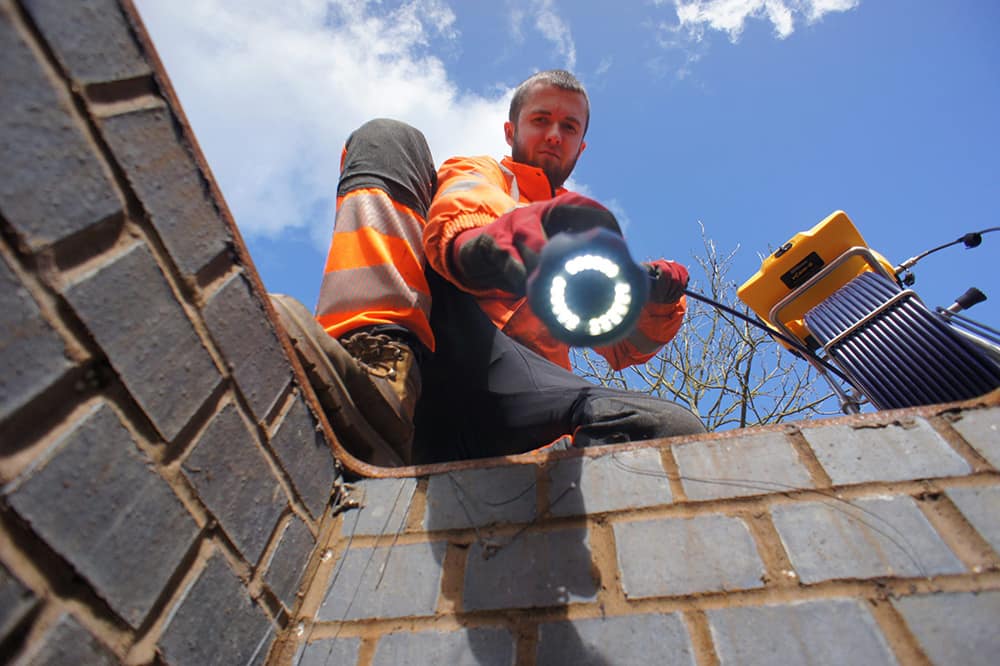
Our team of trained, qualified and fully equipped surveyors will complete your specialised Utility Survey.

3. Complete Your Project With Confidence
Having up to date and accurate Utility Survey records will give you complete confidence in knowing exactly whats beneath you, ensuring your project is completed safely and on time.


Why Choose Amethyst Surveys


At Amethyst Surveys, we have extensive experience in providing professional utility survey services in the UK and Europe, having worked with a wide range of clients, including architects, developers, and local authorities.

Our highly skilled, qualified utility surveyors use the latest technology and equipment for accurate and reliable survey results. Our staff are DBS verified and certifications include NVQ’s in Utility Surveying, GPR training plus SPA, CSCS.

Our team are fully committed to delivering exceptional customer service, and go the extra mile to provide our clients with all the information they require for their projects. We also offer a free, no-obligation quote for all utility survey projects.
Accreditations