New Oxford Street London
Utility Mapping Surveys of New Oxford Street London
Undertaking and delivering highly detailed surveys is our speciality. Our client for this particular project requested a full utility mapping survey to be presented in 2D and 3D model formats.

The Survey: Surveying within busy city footpaths can be a huge challenge. A lot of care must be taken to protect the public, and the survey teams at all costs. Working out of hours or during quieter periods can be essential in certain areas to complete our surveys safely.
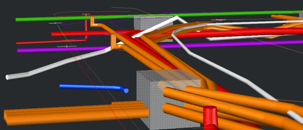
The level of detail required to produce a 3D model of underground utilities is a lot higher than a standard 2D survey. The positions and depths of located services need to be very accurate to produce the model correctly.
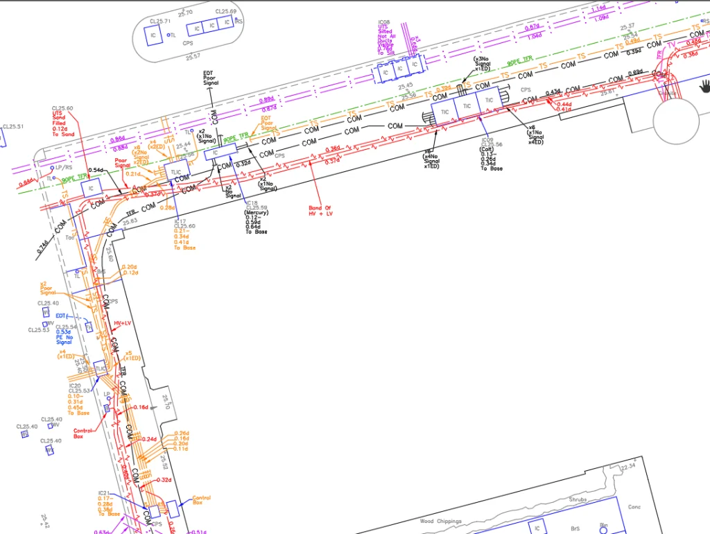
The Results: Following the site survey, the information obtained on site is processed and digitised by our dedicated CAD team. Our team are qualified to produce highly detailed reports in 2D AutoCAD, 3D AutoCAD, and Revit if required.
The survey information provided is to be used for the demolition of the old site, and the redevelopment of the new proposed site. Therefore, the accurate location of services is essential prior to excavation, diversion and design.